VIS 2026VIS 2026 — Virtual Island Summit|Also: GSIS 2027GSIS 2027
Island Innovation Logo
About
Services
The Network
Events
Content Library
Contact Us

News

Curated stories and analysis from islands and sustainability leaders worldwide.
Loading news...

Subscribe to our newsletter. By submitting, you agree to our Privacy Policy.

Island Innovation

Island Innovation works with governments, institutions, and partners worldwide to support island-led sustainable economic development.

We Support The UN Development Goals

SDG 9: Industry, Innovation and Infrastructure
SDG 11: Sustainable Cities and Communities
SDG 12: Responsible Consumption and Production
SDG 13: Climate Action
SDG 14: Life Below Water
SDG 17: Partnerships for the Goals

Explore

AboutServicesNetworkEvents

Content

ArticlesNewsCareers

Ready to Connect?

Join the island innovation community

Get in Touch

About

  • About us
  • Case Studies
  • FAQs
  • Press
  • Careers
  • Contact

Services

  • Services Overview
  • Public & Media Relations
  • Strategic Communications

Network

  • The Island Network
  • Academic Council
  • Newsletter

Events

  • Our Events
  • Watch Past Events

Content

  • All Content Library
  • Videos
  • Articles
  • News
Privacy PolicyTerms of ServiceContactManage email preferences

© 2025 Island Innovation. All rights reserved.

    Filter by Core Theme

    All ThemesCircular EconomyClimate ActionConnectivity & DigitizationCulture & CommunityEnergy & TransportGreen Finance & EconomyOcean & BiodiversityPolicy & GovernanceTourism & Remote WorkWater & Food
    Showing 9 of 2157 news items
    In 1944, 29 Reindeer Were Left on a Remote Island in Alaska, Decades Later, They Had Eaten Themselves Into Extinction
    Ocean & BiodiversitySeptember 3, 2026

    In 1944, 29 Reindeer Were Left on a Remote Island in Alaska, Decades Later, They Had Eaten Themselves Into Extinction

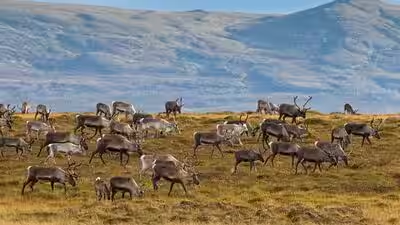
    What happened to the reindeer on St. Matthew Island is a classic story of wildlife boom and bust. In 1944, the US Coast Guard corralled 29 Nunivak Island reindeer on a barge and floated the animals north to the island, more than 200 miles away to one of the most remote places in Alaska. While they initially grew into a population across the land, today the island is devoid of any reindeer, according to a report by AS. A food source The Coast Guard had earlier in the year placed a radio navigation system on the island, along with 19 men. St. Matthew Island is a narrow strip of tundra in the Bering Sea, more than 200 miles from the nearest village. The reindeer were intended as a roaming food source should the men be cut off from supply shipments. The men never shot a single reindeer; the Allies were winning the war, and the Coast Guard pulled its men from the island. But they left the reindeer. Initially, the situation was fine for the animals. Their only predators had disappeared, leaving them on a 32-mile-long, four-mile-wide island rich with their favourite food, lichen. Biologist Dave Klein first stepped on the island in 1957, 13 years after the Coast Guard had abandoned it. Klein, 82, now a professor emeritus for the Univerisity of Alaska Fairbanks' Institute of Arctic Biology, hiked the length of the island with field assistant Jim Whisenhant in 1957. They noted that the herd of 29 reindeer had increased to more than 1,300 animals. Klein returned to the hard-to-reach island six years later. He could hardly believe how many reindeer were there. "We counted 6,000 of them," Klein said in a 2003 interview. "They were really hammering the lichens." But the scene, with its 47 reindeer per square mile, foreshadowed a crash ahead that no one was able to predict. They had trampled vegetation and consumed much of the food that had allowed their extraordinary expansion. The island could accommodate a population boom. It could not keep feeding one forever. For the unversed, a reindeer are large deer that live in the Arctic and sub-Arctic regions of Europe, Asia, and North America. In North America, they are commonly called caribou. They are well adapted to extremely cold environments, with thick fur, broad hooves and a layer of body fat that helps them survive harsh winters. Unlike most deer species, both male and female reindeer can grow antlers, although males generally have larger ones. Out of sight When Klein returned to the island in the summer of 1966, three years since his last visit, the herd of 6,000 had shrunk to a shocking 42. This number included only one male that had abnormal antlers and was probably unable to reproduce. There were no fawns. Moreover, reindeer skeletons littered the entire island. The herd had busted. During the next decade or so, all the reindeer of St. Matthew Island died off. According to the US Geological Survey, the last female died in 1981. According to Klein, an extreme winter might have forced the stressed population to the brink.

    12345678910
    Read more
    At Norway's Newest Island Retreat, Redefining the Relationship Between Community and Tourism
    Tourism & Remote WorkSeptember 3, 2026

    At Norway's Newest Island Retreat, Redefining the Relationship Between Community and Tourism

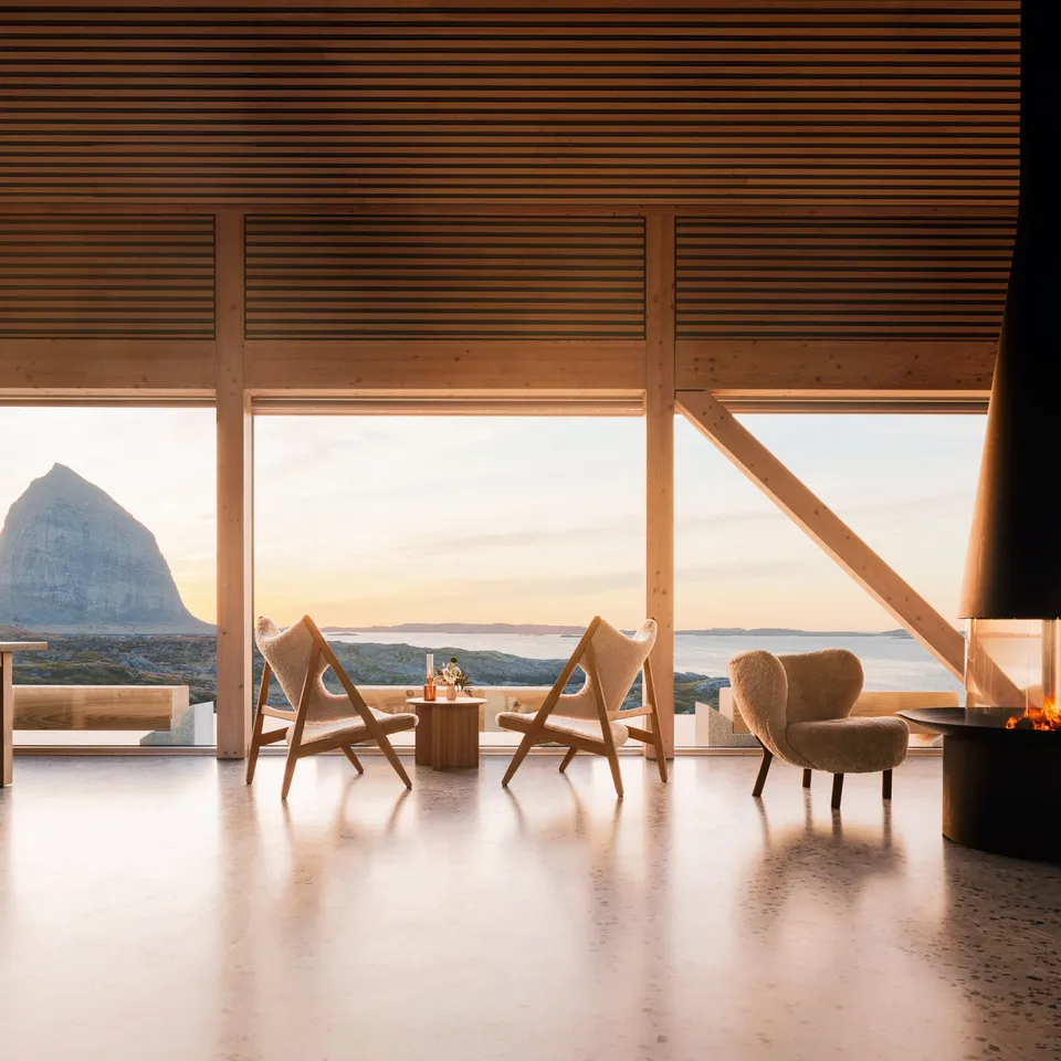
    Traveling to Ytri Island Retreat—which bills itself as “Norway’s most remote island retreat,” and is a 112-mile journey by ferry from the northern coastal city of Bodø—is no small feat. It’s perched on Husøya, one of the 477 islands of the Træna archipelago enfolded by blueberry seas—no wonder that its name means “outer point.” But despite the sobering distance and tales of ferocious winter storms that have been known to blow whole buildings into the sea, I find not so much a rugged, isolated hideaway as a smart, well-oiled operation anchored in its community. The concept of a luxury hotel was mooted by the locals a decade ago when, facing a hollowing-out of the regional fishing industry, the municipality and local development company Træna 365 gathered to brainstorm alternative futures for the archipelago. After six years of planning, investors Asle Helgheim and Ellen Hestenes—keen sailors with an existing Swedish spa hotel—came on board. Since Ytri Island Retreat opened in April, Træna’s population has increased by almost two percent—a sign that the project’s vision of social sustainability is already bedding in. I arrive a few days out from the summer solstice, when the sun appears to move sideways across the sky and the landscape is one of repose. The spartan rocky tufts that unfold from the hotel to the sea are blanketed with moss and wildflowers, and rabbit-tailed strands of swamp wool quiver in the breeze as if they’re bursting to tell me something. Looking back from the shore at Ytri’s cluster of industrial buildings in garnet, mint, and silver—modeled after fishermen’s dwellings—I see its windows catching the golden swell of midnight sun and reflecting a gentle hammered-glass ocean uninterrupted by boats. Inside, the 38 rooms and suites are simple, even monastic: pitched, high, church-like ceilings in pale wood; Norwegian wool cushions and blankets in inky blues and smoky grays; wonky ceramic vases blooming with dried flowers; and a bioelectric fireplace in my suite’s lounge. Design firm Bonaparte Interiør has used local materials such as a terrazzo floor made of sand, stone, and shells from the island, and there are abstract prints by Norwegian artists on the walls and pine-scented Skøn toiletries in the bathroom. But really, the invitation here is to look out. Floor-to-ceiling windows in every room—and a lava-smooth bathtub in mine—all face the emblematic shark-toothed Trænstaven mountain that rears out of the ocean on Sanna island opposite.

    Read more
    This Pacific Island Disappeared Under Rising Seas. A New Sculpture Marking the Spot Will Morph Into a Home for Seabirds, Coral and Marine Life
    Climate ActionSeptember 3, 2026

    This Pacific Island Disappeared Under Rising Seas. A New Sculpture Marking the Spot Will Morph Into a Home for Seabirds, Coral and Marine Life

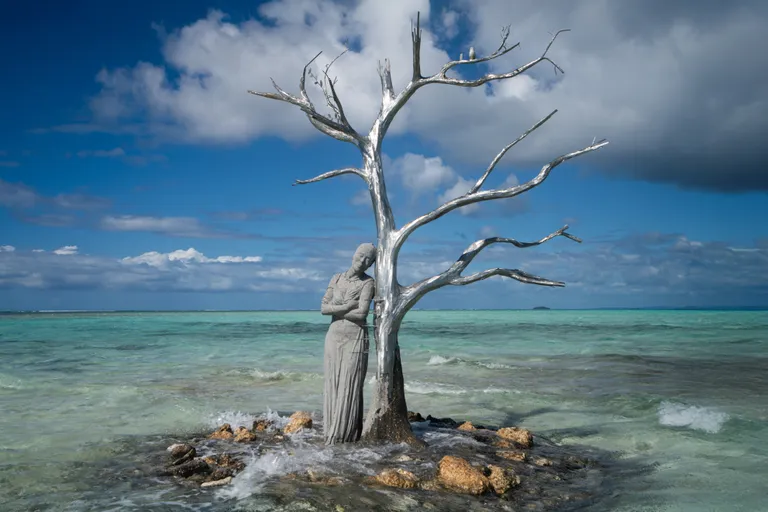
    A decade ago, rising tides in the Pacific Ocean submerged Kale, a 50,000-square-meter island in the Solomon Islands archipelago. Once home to a small community, Kale was one of the first documented islands in the world to be lost to sea-level rise, which continues to threaten the Solomon Islands. Since 2008, more than 26,000 people across the island chain have been forced to relocate from their homes due to the encroaching ocean and extreme weather, Nicola Smith and Charley Piringi reported for the Telegraph in 2023. “With its white sandy beaches, clear waters and lush forests, Kale was a jewel between the ocean and the sky,” wrote climate activist Gladys Habu Bartlett, who grew up on the Solomon Islands, in a 2020 guest blog for the International Institute for Environment and Development. “It was a much-loved spot for people living on the northwest of the Solomon Islands’ Isabel Province and a significant part of our cultural heritage.” Now, to commemorate ten years since Kale was officially lost, a marine artist installed a new sculpture in the intertidal zone where sand intermittently peeks above the waves. The Solomon Siren by British artist Jason deCaires Taylor pays homage to a lost home while also celebrating Bartlett’s environmental activism. “Modeled on Gladys, the sculpture stands as a memorial to a lost landscape and a powerful reminder of the communities already living with the impacts of climate change,” Taylor writes in an Instagram post. The sculpture portrays a life-size figure of Bartlett—who has been recognized internationally for her work to advance gender equity and environmental awareness in the Pacific—resting against a tree that represents the former island’s diverse vegetation and natural resources. The artwork is made from pH-neutral cement and biochar, which creates a porous surface “suitable for marine colonization” by algae, corals and invertebrates, My Modern Met’s Sage Helene reports. Meanwhile, the tree’s branches offer a resting place for seabirds. The sculpture has markings tracking sea level rise in the area in 2006, 2016 and 2026, as well as projected marks for 2036 and 2046 based on climate models. Per a recent United Nations report, global sea levels are rising today at twice the rate of a decade ago. “Year after year, we watched the sea rise. We watched our homeland disappear,” Bartlett says in a video accompanying the sculpture’s debut. “I chose to share our story, and this sculpture is a deeply meaningful part of it. What happened is a warning, not only for us, but for the world.” The sculpture is the latest in Taylor’s ongoing “Siren” series responding to marine ecosystems. His Sirens of Sewage sculpture in Whitstable, England, sought to raise awareness about water companies’ release of untreated sewage along the coast. And his Ocean Siren sculpture off the coast of Australia changes color to reflect the real-time temperature of the Great Barrier Reef, where warming water leads to coral bleaching.

    Read more
    Digital Hospital: Connecting Care Across Nine Islands
    Connectivity & DigitizationSeptember 3, 2026

    Digital Hospital: Connecting Care Across Nine Islands

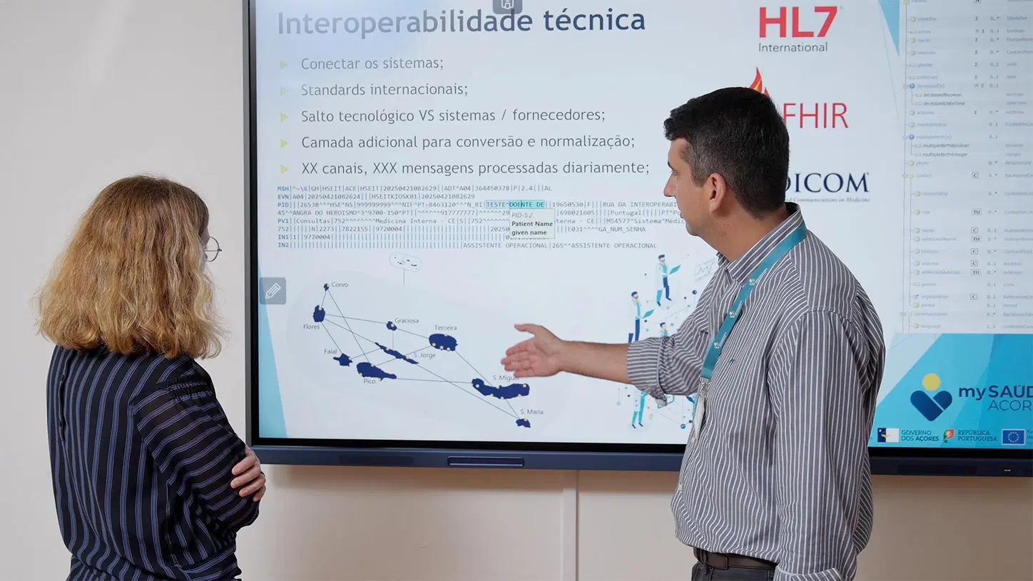
    For the 240,000 people living across the nine islands of the Azores, an archipelago of Portugal, access to healthcare has always been shaped by geography. Patients often face long journeys between islands to reach specialists. Healthcare professionals work across a fragmented network of hospitals, local health units, and care centers. As Regional Secretary for Health and Social Security Mónica Seidi puts it: “The Azores are made up of nine islands, and I would almost dare to say nine challenges.” To address these barriers, the Azores Regional Health Service launched its Digital Hospital project, a region-wide transformation designed to connect healthcare providers, patients, and clinical information across the archipelago. Working with Siemens Healthineers, the initiative is creating an integrated digital ecosystem built around a unified electronic health record, patient and physician portals, teleconsultations, and standardized clinical data. Improving access to specialized care through digital healthcare The goal is clear: ensure that high-quality care is available regardless of where patients live. Instead of traveling by plane for routine specialist appointments, patients can increasingly access care virtually, review medical records online, manage prescriptions, and schedule appointments through a single digital platform. Connecting clinical data for better patient care For healthcare professionals, centralized information means more informed decisions and fewer administrative barriers. As physician Lénio Couto explains: “Centralizing data allows us to spend more time with patients, to talk with them. It’s not a separation, but rather a way to get closer.” The impact is already becoming visible. Patients can access consultations, exam results, and vaccination records online, while teleconsultations are reducing travel and improving access to specialist expertise. Digitalization is strengthening coordination across the islands, reducing redundancies, and supporting safer, more efficient care.

    Read more
    Singapore to Merge Several Outer Islands to Form New Western Island
    Climate ActionSeptember 3, 2026

    Singapore to Merge Several Outer Islands to Form New Western Island

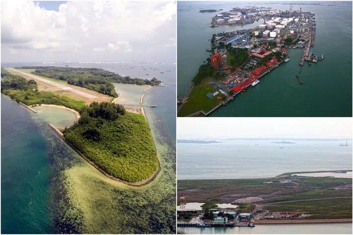
    Singapore intends to merge several southern islands to create a new “western island” in the coming decades for a new generation of industries, power generation infrastructure and defence needs. Pulau Semakau, Pulau Bukom and Pulau Sudong are among the islands that could be merged through planned land reclamation announced by Prime Minister Lawrence Wong on Aug 23 at the 2026 National Day Rally. PM Wong said the new island follows the example of Jurong Island, a global energy and chemicals hub that was formed from the reclamation of several offshore islands. That investment has delivered lasting benefits for Singapore, he added, citing Jurong Island’s role in creating jobs and anchoring important industries, making Singapore a critical node in global energy flows, and strengthening its energy security and resilience, most recently amid the disruptions in the Middle East. Said PM Wong: “Jurong Island was the result of bold decisions, careful planning and sustained investment over many decades. “Now it’s our turn to think just as boldly, and build for the next generation.” He said that every piece of land matters in Singapore, where space is needed for homes, jobs, transport and infrastructure. At the same time, the Republic cherishes green spaces, biodiversity and places with heritage and history. “Sometimes, difficult choices and trade-offs have to be made. “Where development is necessary, we study the impact carefully, make adjustments and minimise the disruption.” Nearly half of Singapore is covered in greenery, PM Wong pointed out, adding that Singapore is continuing to expand its green spaces and strengthen native biodiversity. He stressed that the Singapore way is to plan far ahead by creating new options for future generations so that they will have room to grow, while preserving what is precious about the city-state. He said: “We plan 50, 70, even 100 years ahead. We plan with every Singaporean – born and not yet born – in mind.” To create some of these new possibilities, the Government is looking to transform Singapore’s outer islands, said PM Wong. He highlighted a cluster of islands south of Jurong Island, which includes Pulau Semakau that houses Singapore’s only offshore landfill, Pulau Bukom where the nation’s first refinery still operates, and Pulau Sudong. According to a video shown at the rally, the reclamation profile for the area could also absorb Pulau Hantu, Pulau Jong and Pulau Sebarok.

    Read more
    Can The 2027 Indian Ocean Games Transform Tourism in Comoros?
    Tourism & Remote WorkSeptember 3, 2026

    Can The 2027 Indian Ocean Games Transform Tourism in Comoros?

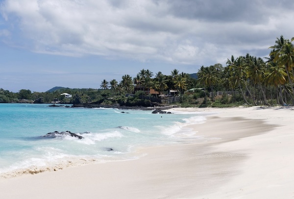
    The Comoros Islands have long possessed the ingredients of an Indian Ocean tourism success story: volcanic landscapes, largely undeveloped beaches, coral-rich waters, a distinctive blend of African, Arab and French influences, and a location between East Africa, Madagascar and the established island destinations of Mauritius, Seychelles and Réunion. What Comoros has lacked is not tourism potential, but the infrastructure, connectivity, investment pipeline and international visibility required to convert that potential into a functioning visitor economy. The 2027 Indian Ocean Island Games, known by the French acronym JIOI, could become a rare opportunity to change that trajectory. Yet the Games will only produce a lasting tourism dividend if the accommodation, transport and sporting investments being planned are designed for commercial use long after the athletes have returned home. At the center of one proposed legacy project is Faouzia Vitry, a former Réunion regional political figure with extensive experience in Indian Ocean cooperation. Information provided to eTurboNews says Vitry has been appointed to lead a special-purpose company responsible for developing an accommodation village for the Games. The proposed development would include approximately 200 villas used to house participants during the sporting event before being converted into permanent residential or tourism accommodation. The plan is ambitious. It could provide Comoros with desperately needed room capacity and create an investable real-estate product for Comorians, the diaspora and regional partners. It could also become an expensive post-event liability unless ownership, utilities, management, access and market demand are settled before construction begins. Independent public documentation confirming the SPV’s complete financing structure, construction timetable and final commercial model remains limited. These details will be essential in judging whether the village is a bankable tourism development or primarily a Games-related accommodation solution. Faouzia Vitry Returns to Indian Ocean Regionalism Vitry’s appointment would reconnect several strands of Indian Ocean tourism history. In 2016, she represented Réunion at the Carnaval International de Victoria in Seychelles, an event associated with former Seychelles tourism minister Alain St. Ange and designed to bring cultures and tourism destinations together through a highly visible international carnival. At that time, Réunion and Comoros were both associated with the Vanilla Islands regional tourism initiative, which sought to market the Indian Ocean islands collectively rather than as isolated destinations. Vitry later served as a vice president of the Regional Council of Réunion. Regional documents identify her as having held responsibilities connected with education, youth, the Vanilla Islands and regional affairs. According to the information supplied to eTurboNews, she also managed regional cooperation programs with a budget of approximately €64 million and served in municipal and community positions in Saint-Denis. Her move to Comoros is therefore more than a conventional property appointment. It signals an attempt to bring regional political experience, institutional knowledge and diaspora engagement into a project that Comoros hopes will survive beyond 2027. eTurboNews contacted Alain St. Ange, who described the proposed Games village as an opportunity to bring Comoros more visibly onto the tourism map. His broader argument is familiar across the Indian Ocean: major events are most valuable when they leave usable hotel rooms, transport links, public spaces and international awareness rather than empty structures. What Are the Indian Ocean Island Games? The Indian Ocean Island Games are a regional multi-sport competition involving Comoros, Madagascar, Maldives, Mauritius, Mayotte, Réunion and Seychelles. The event was created to promote sporting competition, friendship and cooperation among the islands and is generally held every four years. Comoros is scheduled to host the 12th edition in Moroni in 2027. Recent regional reporting says 18 sporting disciplines have been approved, with the Games expected to run from August 24 into early September. The program includes athletics, swimming, football, basketball, handball, judo, karate, volleyball, table tennis, tennis, pétanque and para-sport events. Hosting the Games is significant for Comoros because the country has never before had to provide accommodation, sporting facilities, transportation and event services at this scale. A regional inspection has already raised the issue of slow infrastructure progress. That does not mean the Games cannot be delivered, but it compresses the time available for procurement, construction, testing and operational training. The event could attract several thousand athletes, officials, media representatives, contractors and supporters. Even if the direct visitor volume is modest by global mega-event standards, it would represent a substantial demand shock for a destination whose tourism economy remains small. Comoros Has the Product, but Not Yet the Tourism System Comoros consists principally of Grande Comore, Anjouan and Mohéli, while Mayotte is administered by France and remains politically disputed. Grande Comore offers the capital, Moroni, the active Mount Karthala volcano, lava landscapes, traditional towns and beaches framed by black volcanic rock. Anjouan is greener and more mountainous, with historic settlements, waterfalls and agricultural landscapes. Mohéli has perhaps the strongest ecotourism proposition, including marine biodiversity, nesting sea turtles, whales and community-based conservation. The country’s tourism potential has been recognized for years. A World Bank tourism review identified nature, culture and marine assets but also highlighted weak infrastructure, limited skills, poor destination management and inadequate connectivity as major barriers. The numbers demonstrate how far Comoros remains from its Indian Ocean competitors. Central-bank data cited by Trading Economics indicate 21,718 tourist arrivals in 2024, compared with 20,297 in 2023. Even allowing for differences in statistical methods, this is a fraction of the annual traffic handled by Mauritius, Seychelles or nearby Zanzibar. Low visitor numbers are not necessarily a weakness. They give Comoros a chance to avoid the high-density resort model and position itself around nature, culture, community tourism and small-scale luxury. But exclusivity by itself is not a tourism strategy. Travelers still need reliable flights, functioning roads, quality accommodation, trained guides, safe boats, medical support, electricity, water, telecommunications and predictable booking channels. The United States’ travel guidance states that formal tourism infrastructure is limited and warns that emergency response and medical treatment capacity are inadequate. Canada similarly advises travelers to exercise a high degree of caution because of limited emergency and medical services. Those warnings are commercially important. International tour operators, insurers, corporate travel departments and event organizers consider medical evacuation, emergency planning and duty-of-care standards before placing clients in a destination.

    Read more
    The Extinction of Languages Is an Environmental Issue
    Culture & CommunitySeptember 3, 2026

    The Extinction of Languages Is an Environmental Issue

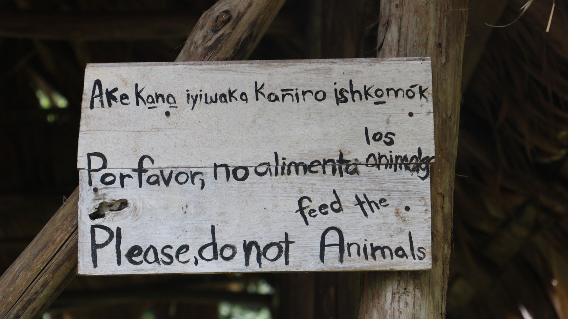
    More than 2,000 Indigenous languages are at risk of disappearing this century — and with them we could lose vitally important traditional ecological knowledge. Environmentalists, myself included, pay close attention to gloomy topics like species extinctions and Earth’s dwindling life-support systems. It’s not for the love of dark matters that we keep tabs on depressing metrics. Rather, it’s with the hope that they teach us something and guide us toward mitigating future losses. On the biological front, about a million species could be taken by an extinction vortex by the end of the century. That’s also when linguists estimate about one-third of the world’s 7,000-plus Indigenous languages will go silent — and with them, most of their related cultures. This is not uplifting news, to be sure. Nonetheless, people concerned with environmental protection can learn a lot from language extinctions. As it turns out, the survival of languages and species may well be linked. And when we wrap our minds around this, the panorama for conservation actually gets a little brighter. A Confluence of Curious Similarities Linguistic variation around the world caught the imagination and attention of naturalists going back at least to the Victorian era of exploration, when folks like Alfred Russell Wallace and Charles Darwin traveled across the wilds of South America and the Malay Archipelago. Wallace marveled at the linguistic diversity shown by communities spread along the edges of the watery world in the Amazon basin and dotting the highlands of New Guinea. He even wrote out partial lexicons to aid in communicating with his guides. Darwin, in his ruminations on the descent of man, went so far as to remark that languages and species are “curiously the same.” He was thinking about human evolution and wondering if languages might evolve by natural selection. With his thoughts on the flowering of languages, he did not give time to their senescence. It would take more than 100 years, after the concurrent publication of Darwin and Wallace’s theory of natural selection, for scientists to uncover the full extent of global linguistic variation, and also the languages’ risk of extinction. Today the patterns emerging from these discoveries hold lessons for environmentalists. One of the pioneering explorations was conducted by Larry Gorenflo (Penn State University) and his team of conservation biologists and linguists. Their labors produced some profound findings. First off, the places on Earth with outrageously high numbers of species also have outrageously high numbers of Indigenous languages. Furthermore, many of the species and languages of these hyper-rich spots are endemic. They don’t occur, much less co-occur, anywhere else. Gorenflo and team went on to examine language diversity in regions that conservationists designate as “priority areas.” A second striking fact emerged: High-priority conservation regions are home to nearly 70% of the world’s languages. These results demonstrate we can either win big or lose big, depending on the success of our efforts in these doubly diverse hotspots. It’s like playing a Daily Double, with “How to save life on Earth?” as the question to the answer. Lullaby for Language Extinction is forever. Except when it’s not. This isn’t a reference to de-extinction and the facsimiles brought into existence by technology. It’s about languages. When the last speaker of a language falls into eternal slumber, so does their language. Linguists say that such languages are “dormant.” Dormancy is different from the extinction of biological species, at least in principle. Sleeping languages can, hypothetically, experience reawakening. That is, they can be spoken again after a period of dormancy, but only under special circumstances. At a minimum there must be a written record of the lexicon and syntax. For instance, Hebrew came back in the 19th century after a long slumber. Sadly, however, the vast majority of Indigenous languages only exist in the oral form, making linguistic resurrections nearly impossible. This is why dormancy and extinction are, for all intents and purposes, synonymous. It’s also why we must work to document and teach Indigenous languages before they nod off. High Tolls for Both Languages and Species Just as the vastness of language varieties was unearthed, the global decline became apparent as well. Nowadays researchers race to figure out what drives language endangerment. Lindell Bromham and Xia Hua (Australian National University) are two such investigators, who lead a large interdisciplinary team analyzing the subject. In a recent cutting-edge study of massive scope and scale, the team uncovered the principal determinants that drive the downturn. One of the top three is strangely simple: roads. “Greater road density, which may encourage population movement, is associated with increased (language) endangerment,” Bromham and team conclude. You might say that roads compromise the linguistic intactness of a landscape. Conservation biologists, well versed in the dangers that roads pose to natural ecosystems, should relate to that. This is not to suggest that road effects are perfectly analogous in their impacts on languages and species. There are major differences. They have to do with the paradoxical capacity of roads to both create and destroy connections. For remote ethnolinguistic groups, a frontier highway increases connectivity. Distances that once required weeks or more to cross may be traversed in hours or days. Lines of communication suddenly open — for material goods, of course, but also for the transmission of diverse ideologies and ways of life. When this happens with high speed or without guardrails, a collision with cultural traditions and language preservation ensues. Often, such roads are the handiwork of large industries, looking to make money in the frontier, usually at the expense of local peoples whose lands they usurp. One of the first casualties of enhanced contact is the local vernacular. This is a big blow to culture, potentially harming people’s health, wellbeing, and identity. The loss is accompanied by a shift to another language, usually the parlance of government, business, and education. A new sociocultural reality arises as the highway expansion continues. By contrast, roads harm ecosystems by severing connections. Effectively, highways fracture natural populations and break the fundamental rules of ecology. Renowned ecologist and conservation biologist Dr. William Laurance (James Cook University) tells me that bulldozing through forest expanses is like opening Pandora’s box. “It’s because of the transformative effect that (roads) have,” he says. “They’re the single most important proximate driver of environmental change and degradation. A road goes in and six months later the forest is split open like a splayed fish.” In distant lands, far from government regulation and oversight, a motorway quickly spawns ghost roads — unauthorized byways branching from the central transit spine. In short order, plantation monocultures flatten forests and open-pit mines erupt like infectious pocks. The cleavage of habitats puts native plant and animal populations at greater risk of declines, even extinctions. Curbside, roadkill piles up. So while highways and their byways exert harm in different ways, they are nonetheless critical factors that must be reckoned with, for both conservationists and linguists. We Don’t Need No Education? The work by Bromham and team produced a result that may run counter-intuitive to every reader of this piece. Next to roads, say the investigators, the biggest threat to languages is formal education. Educators may shake their heads, but there’s good evidence that Bromham and colleagues are right. They argue that monolingual education can lead to language shifts, with local Indigenous languages yielding to rising tongues. Young people, looking ahead to professional careers, may be strongly incentivized to adopt the language that advances their aspirations. Various lines of evidence suggest this is, indeed, what happens. An example comes from Papua New Guinea, a tiny nation in Melanesia whose name graces the very top of the list of language-rich countries. That diversity is endangered, in large part, due to high school education, say Alfred Kik (University of Goroka) and Vojtěch Novotný (Czech Academy of Sciences). They’re long-term investigators in Papua New Guinea who have been documenting students’ Indigenous language skills and knowledge of local flora and fauna. Their work demonstrates a “precipitous” decline in both. The result derives, they argue, from the push for children to learn English, which is used in schools and perceived to be the language of opportunity. The shift is also related to the spread of Tok Pisin, a type of pidgin English used extensively as the lingua franca in multilingual settings, including cafeterias and playgrounds. The message is not that formal education should be eliminated for the sake of global linguistic diversity. The lesson, rather, is that the language of instruction, which is usually determined by education policy and funding availability, is highly consequential. Multilingual education is a possible antidote, especially in the context of environmental education.

    Read more
    Scientists X-Rayed Ancient Penguin Bones From Remote Antarctic Island. Here’s Why.
    Climate ActionAugust 27, 2026

    Scientists X-Rayed Ancient Penguin Bones From Remote Antarctic Island. Here’s Why.

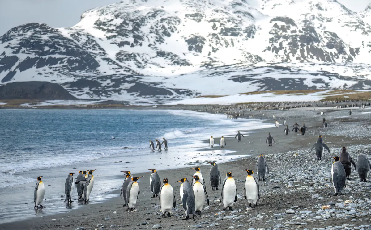
    A study of penguin fossils, conducted by researchers from China University of Geosciences in Beijing, has revealed how ancient bones can offer a glimpse into climate change from millions of years ago. This study, published in the journal Fossil Record, is the first use of vertebrate fossils to reconstruct ancient climate change, linking penguin bone chemistry to Antarctica’s environmental history. The penguin fossils, found on Seymour Island (located around the tip of Graham Land on the Antarctic Peninsula), date back to the Eocene epoch, which spanned approximately 34-56 million years ago. Seymour Island provides insight into a significant chapter of Earth’s history of climate change. As the island’s rock layers stack up in a mostly unbroken sequence, they offer a unique look into major geodynamic changes, including the initial growth of the Antarctic ice sheet and the opening of Drake Passage. This makes Seymour Island a rare natural laboratory for tracing how climate conditions on our planet shifted over millions of years. Although scientists traditionally relied on whole-rock geochemical approaches to study this area, this new study offers a fresh source of environmental data. “Penguins are among the most iconic animals of Antarctica and represent one of the most distinctive groups of birds, having completely lost the ability to fly and instead using their flipper-like wings for swimming,” say the research team. “Seymour Island preserves one of the world’s richest and most stratigraphically continuous records of Eocene penguin fossils. These fossils span an important interval of Antarctic climate evolution, from the relatively warm and humid conditions of the early Eocene to the cooler climate of the middle and late Eocene.” The fossil chemistry To analyse the fossils, the scientists used a technique called micro-X-ray fluorescence mapping, which allowed them to map chemical elements across the surface of the bones. The analysis found that the oldest fossils, from around 54-55 million years ago, had much higher levels of titanium, silicon and potassium. These chemical patterns point to intense rock weathering – a sign that the climate of that time was warm and humid, causing more erosion and runoff into the area where the penguins died and their bones fossilised. “Based on the statigraphic, sedimentological and paleoclimatic evidence, we interpret this pattern as being consistent with stronger continental weathering and terrestrial material input under the warm and humid conditions of the early Eocene,” adds the research team. The scanning method also detected iron, manganese and sulphur patterns trapped within the bones – reflecting local chemical changes in the marine sediment as the fossils were buried over millions of years.

    Read more
    Canary Islands and Galapagos: Common Challenges And Collaboration in Innovation and Sustainability
    Policy & GovernanceAugust 27, 2026

    Canary Islands and Galapagos: Common Challenges And Collaboration in Innovation and Sustainability

    Canary Islands and Galapagos will seal a key agreement in August to boost innovation and sustainability. Discover how this alliance will address crucial challenges such as energy, water, and biodiversity for the islands. The Government of the Canary Islands plans to sign a line of work next August with the Ecuadorian archipelago of Galapagos to address issues of interest to both territories in terms of innovation and sustainability and to exchange knowledge in this regard. The Deputy Minister of the President's Cabinet, Octavio Caraballo, will visit this area and will hold a meeting with the authorities of the Galapagos Special Regime Council to lay the foundations for stable cooperation between both archipelagos. Caraballo highlighted that this collaboration arose from the interest shown by the Galapagos authorities in the research and innovation being developed in various centers in the Canary Islands, which they learned about at the II edition of DiploInnova Canarias, held in Madrid last February, which focused on Oceans and Climate Change. In this meeting, the numerous affinities shared by both archipelagos were noted, characterized by their unique island condition, their extraordinary natural heritage, their strategic relevance, and the common challenges arising from biodiversity conservation, sustainability, resilience to climate change, and the need to move towards balanced and innovative development models. Galapagos and the Canary Islands recognize that island territories are reference points for innovation and the generation of sustainable solutions to global challenges. Both regions have shown interest in consolidating cooperation that favors the exchange of knowledge, the identification of good practices, and the international projection of both archipelagos as benchmarks in the sustainable development of island territories. In this context, the Canary Islands aim to promote a stable relationship of institutional collaboration with the Ecuadorian archipelago based on the exchange of experiences, mutual learning, and technical cooperation in aspects such as the energy transition and sustainable mobility; sustainable water management; biodiversity conservation, biosecurity, and invasive species control; territorial planning, island governance, and demographic challenge management. Likewise, it is in the interest of the Canary Islands and the Galapagos Islands to work together on circular economy and waste management; food sovereignty and sustainable territorial development; the conservation and sustainable management of the marine environment and fishing resources; adaptation to climate change and strengthening the resilience of island territories, or innovation, knowledge transfer, and exchange of good practices in public policies for island territories. The objective is to be able to carry out an exchange of technical delegations and researchers from the two territories and facilitate the transfer of knowledge applied to public policies, as well as organize thematic sector workshops and establish specialized working groups in these areas, in addition to developing joint pilot projects.

    Read more